 |
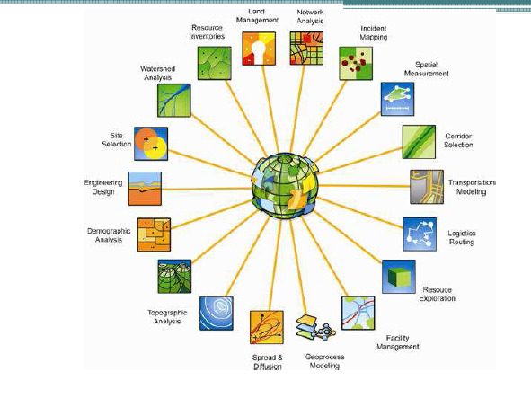
| Applications of GIS Source: Richard Nash 2012 |
GIS is not only a tool for professionals in the field, but one that can have great outcomes when used for Public Participation (PPGIS). The visual representation of information allows for members of the public to easily gain an understanding of the scope of proposed projects. When used in conjunction with the opportunity to provide feedback regarding developments, is an empowering tool for the public and useful tool for planners to gain an understanding of concerns.
Whilst the GIS is a commonly accepted technology in the planning process, other tools such as virtual globes are still relatively new and not widely used. Virtual globes are a model or representation of the Earth using 3D software. They have many benefits, namely: raising interest, awareness and access to issues by the public. For example, it is likely that the public will pay greater attention to information about the risks of climate change, if a visuals representation of a certain area is shown, with the impacts overlayed, giving a realistic view of potential harm. There are however, a number of drawbacks to the use of such technology, in particular, the potential for misinterpretation of information. There is the possibility for virtual globes to overemphasise issues, causing viewers to panic.
Like all technology, there are benefits and negatives, but if obstacles are overcome, virtual globes have the potential to revolutionise the planning process, and empower the public.
If you are a planner, how do you use GIS at the information session with community?
ReplyDeleteWell-done to your all blog posts!